On this page
Part of the tutorial: page 7 of 12
▶ Watch this page: part 7 of the tutorial video (about 1 min), with narration and subtitles.
Tutorial 7: Roads and sea lanes
Draw a road and a sea lane of your own by their waypoints, and reshape a route by moving a waypoint.
Start from: 06-realms-and-provinces.json, the map as it is at the end of Tutorial 06 Realms and provinces. Download it, then open Maps on the rail and click Import JSON; the map is listed under its name, and Load opens it. Or carry on with your own map from Tutorial 06 Realms and provinces.
The Routes and pins tool places the lines and points of the map: routes (roads, sea lanes and the river trade the run made) and pins (places). A route is a chain of waypoints, and the module finds the way between each pair for you over the map's cells: a road keeps to land and winds round steep ground, a sea lane keeps to water.
Steps
-
Click Routes and pins on the rail and choose Route at the start of the bar. The panel lists every pin and every route on the map; the run on page 5 made thousands of each. The search field and filters above each list narrow it.
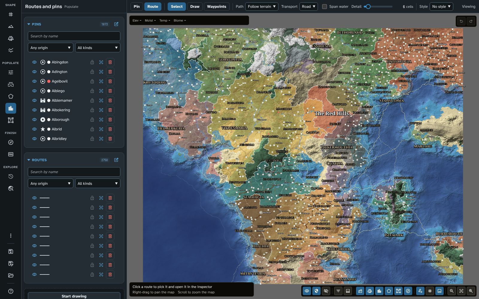
Routes and pins, in Route mode.
-
Choose Draw on the bar. Leave Path at Follow terrain and Transport at Road, and set Style to Trunk road. Zoom in on the Red Hills, then click three waypoints through them, south to north: the capital Pickermouth, the city Kineley, and the city Castford. As you move, the leg the next click adds is previewed. Press Enter (or right-click) to finish the road; it opens in the inspector.
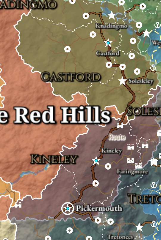
The new road, found over the terrain between its three waypoints.
Drag instead of clicking to trace a stretch: when you let go, the stroke's bends become waypoints. Backspace, Ctrl+Z or Undo takes the last click back while you draw.
-
In the inspector, change Name to The King's Road and press Enter.
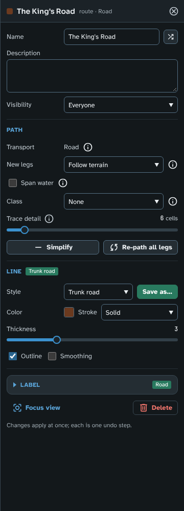
The King's Road in the route inspector.
-
Choose Waypoints on the bar (in More on a narrow bar). The road's waypoints show as handles. Drag the middle one, at Kineley, a little west: its two legs are found again as you move it.
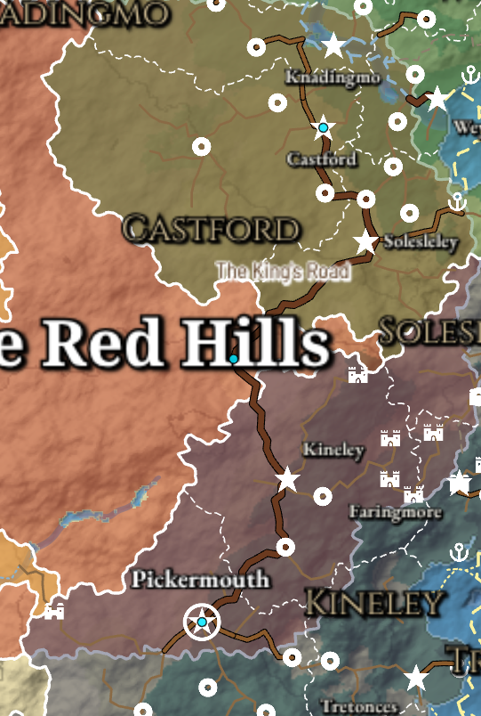
The road after its middle waypoint was moved west.
In Waypoints mode, Shift+Click a route to add a waypoint, Ctrl+Click a waypoint to remove it, and Alt+Click an inner waypoint to split the route in two there.
-
Click Reset view, choose Draw, set Transport to Sea and Style to Sea lane. Click the water off the east coast of the continent, south of the Red Hills, then the water off Chisterton, on Islemark's west coast, and press Enter. A sea lane keeps to the water, rounding the coast. In the inspector, change Name to The Islemark Crossing and press Enter (a new route is called Route until you name it).
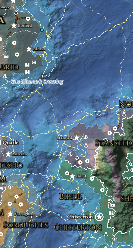
The Islemark Crossing, from the continent to Islemark.
-
Choose Select on the bar, close the inspector, and save the map.
What you should see
A trunk road, The King's Road, from Pickermouth north through the Red Hills to Castford, bending west where you moved its waypoint, and a sea lane, The Islemark Crossing, from the continent's east coast to Chisterton on Islemark.
To compare your map with the tutorial's, or to start the next page from exactly this map, download 07-roads-and-sea-lanes.json and import it in Maps with Import JSON.
In Foundry
Everything on this page is the same in Foundry.
On your own map
Route names are placed after the names of places and regions, so on a crowded map a route's name may have no room and is left out; page 8 shows how to place one yourself. A road you draw near an existing road tends to join it rather than run beside it, which is usually what a road network wants; add a waypoint where it should keep its distance. Span water lets a road bridge a strait or river where going round would be longer. To restyle every road of a kind at once, change its route style in Styles and icons. The Travel tool times journeys along the map's routes, yours and the run's alike. See Routes and pins for every mode, the inspector and mass edit.
Next: Tutorial 08 Places and labels
Related: Routes and pins, Styles and icons, Travel